The Caribbean Sea is a tropical open sea in the Atlantic Ocean, in the eastern part of the isthmus. Due to its proximity to the Antillean arc, it is often called the Antilles Sea.
The first inhabitants of the Antilles islands were the taínos, a sedentary and polytheist tribe with good agriculturists, fishermen and potters. The tribe descended from migrating South American tribes.
In 1502, Christopher Columbus discovered Costa Rica’s Caribbean on his fourth voyage, specifically Playa Uvita.
Twenty two years later, Hernan Cortes mapped the entire Caribbean coast after visiting the country. The Limon province is Costa Rica’s Caribbean coast, extending from Nicaragua to Panama and covering 200 km. The province is divided in the North and South districts. North Limon goes from the Tortuguero Canals to Nicaragua’s border. The South of Limon is the Talamanca coast.
Limon history
Caribbean CoastLimon is located in the eastern part of the country. It limits with the Caribbean Sea (to the northeast), with Heredia, Cartago and San Jose (to the west), with Puntarenas (to the southwest) and with Panama (to the southeast).
Limon is Costa Rica’s Caribbean pearl. It’s well known for its great cultural diversity (with a predominantly black population, indigenous, Afro-Caribbean, white and Chinese communities, each group contributing to Limon’s unique style.
It has a typical hot climate and it’s very humid, with an average annual temperature of 25.5º C.
Limón is 209 km east of San José. Costa Rica’s highest peaks are located in the southern part of the Limon province, in the Talamanca mountain range. The Chirripó hill is 3.819 m high and its temperature may drop down to zero degrees Celsius at night, during dry season. In 1973, a slight snow fall was reported in the area.
Several petroleum refiners and state institutions have placed their headquarters in Limon, such as RECOPE and JAPEDEVA. Limon is a slightly industrialized zone, mostly dedicated to agriculture, with a massive production of banana, making Costa Rica the second biggest banana exporter in the world.
Limon is home to Costa Rica’s most important port, being one of the greatest transit centers in Latin America.
Apart from its economy importance, Limon is another Costa Rican natural paradise, with over 336 km of white sand beaches, exuberant vegetation and important national parks.
ATLANTIC HILL
Puerto Limon
Puerto Limon has an extension of 1.765,79 km² and a population of 105.000 habitants. It’s divided in four districts: Limon, Valle de la Estrella, Rio Blanco and Matama. The city of Limon is the province’s capital city.
The Limon port is the most important one in the country and is one of the greatest transit centers in Latin America.
Guápiles
Extension: 2.403,49 km²
Inhabitants: 115.000
Cantons: Guápiles, Jimenez, Rita, Roxana, Cariari and Colorado
Main town: Pococí
The city of Guápiles is an important commercial and banking center. It has numerous schools and important universities, as well as superior public and private education institutions. It is a prosperous agricultural and cattle region and the heart of the ExpoPococí (an annual fair, one of the most important in the country).
The Tortuguero National Park is located in the northern part of the canton. It’s one of the most visited sites in the country and it’s famous for its amazing natural beauty, its biodiversity and, of course, for the presence of marine turtles that arrive on the beach for egg-laying.
Guapiles is right next to Puerto Limon and can be easily accessed through a modern highway.
Tortuguero National Park
The Tortuguero National park is located Limon, containing the greatest sample of humid tropical forest. Visitors may cross the river channels, observe the wide variety of flora and fauna, witness the egg-laying of the marine turtles and observe over 300 bird species.
Siquirres
Extension: 860.19 km ²
Population: 59.000 inhabitants
Districts: Siquirres, Pacuarito, Florida, Germania, Cairo and the Alegría town
Siquirres is the third canton in the province of Limon. It’s the province’s center, with low lands and lower temperatures (around 29°C).
Suquirres’ main activity is agriculture. Even though the production of banana and pineapple is extremely important in the area, tourism has acquired great importance as well, with thousands of travelers visiting the Pacuare and Reventazón rivers every year.
Talamanca
Extension: 2.809, 93 km ²
Population: 30.000 inhabitants
Districts: Bratsi, Sixaola, Cahuita and Puerto Viejo
Talamanca is the largest of the six cantons if the province of Limon. It displays a great biodiversity thanks to the climate (from the humid to cold).
Its beaches are considered to be some of the most beautiful in the country, such as Cahuita, with a unique barrier of chorales, the Vargas Port, Puerto Viejo beach, Gandoca- Manzanillo beach, Black beach and many more.
The reserve named Hitoy-Cerere is a very popular destination as well.
Talamanca has a wide variety of ethnic groups: Cabecar, Bribri, descendents from Africa, China, etc. In addition to the Spanish language, each community keeps its own language
Matina
Matina’s main town is called Batan and it’s one of the most important commercial centers in the area. Agriculture is Matina’s main economical activity, as well as the cattle ranch. It’s 168 km from San José and is divided in 3 districts: Matina, Batan and Carrandi.
Matina’s climate is rainy, typical of the Atlantic slope, with temperatures oscillating between 24 and 30 ºC.
Guácimo
Guácimo is the sixth and most recent canton of Limon. It has 5 districts, Guácimo, Mercedes, Pocora, Rio Jimenez and Duacari.
In the district of Mercedes, a very important university is situated. It is known as the EARTH, Humid Tropical School, internationally recognized for its high quality academic program on tropical agriculture investigation.
Guácimo is located in the plains of the Caribbean and has vast areas ideal for banana, yucca and maize cultivation. Some lands are also dedicated to the cattle ranch.
It’s also characterized for its archeological excavations that take place all over the region. Costa Rica’s National Museum has made excavations that have revealed roads and pavements, which demonstrate the great importance of indigenous establishments in the area. Known as the Old -Line, this route connects Guápiles, Guácimo and Siquirres.
Around Puerto Limon
Uvita Island: It’s located 1 km away from the Limon coast and only 20 minutes from Limon port by boat. Uvita’s surfing beach is one of the main attractions in the area; as well as it is a beautiful clean and protected beach.
Bonita Beach: The sandy seashore and an amazing ocean characterizes this beach. Surfers love this beach because of its reef break, making waves a lot more powerful.
Moin: People visiting Moin may take a boat from there and get to many other interesting destinations such as Parismina, Tortuguero and even Barra del Colorado
Northern Caribbean
Lots of rivers and canals characterize this zone. A climate between humid and tropical makes people feel in a fresh beach. Lots of forests and amazing nature surrounds this protected area. Flora and fauna is found everywhere in the Caribbean.
Parismina
This city is located in the south of the Tortuguero National Park. Parismina is known especially for its river. Turtles and tarpon lovers often visit this place. Parismina is surrounded by a river. Some places are accessible only by boat. The principal sport in this town is sport fishing. The best season to visit is from January to May.
Tortuguero National Park
This park is located in the north of Tortuguero town and south of Parismina. It’s known for being one of the rainiest areas in the country and for its famous canals.
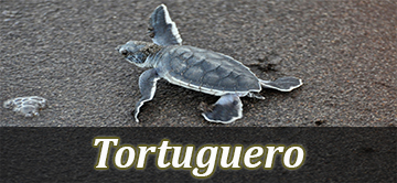
The park has 31,187 terrestrial hectares and 52,000 marine hectares. Turtles procreate in this national park and are the main attraction of the area, however, there are lots of other interesting animals as well, such as monkeys, frogs, iguanas, fish, crocodiles, manatees, pumas, etc.
Tourists can go hiking, boating, turtle, bird and wild life watching, as well as trying delicious local sea food.
Getting there
Air: In Tortuguero a small airfield 4 km away from Tortuguero downtown will help you get there. Nature Air and Sansa have daily flights.
Boat: There are two places where you can get a boat, from Cariari and from Moin ports.
Barra Del Colorado
With approximately 90,400 hectares, Barra del Colorado is home to a wide variety of flora and fauna. The refugee has 50 km of coast; in addition, lots of kilometers are distributed in channels, lagoons and rivers. The San Juan, Colorado and Chirripo rivers make their way towards the Caribbean Sea.
Barra Del Colorado may be more expensive and difficult to visit than Tortuguero. Mammals, caimans, crocodiles and different species of fish are found in the area. Impressive birds, wild cats, monkeys and tapirs characterized this zone. Activities like fishing, canoeing and kayaking can be part of traveler’s adventures.
Southern Caribbean
In this part of the country, visitors can really immerge into the Afro Caribbean culture. Due to the United Fruit Company placed in the region, many Jamaicans came to work in the Atlantic. There are man other ethnicities found in the southern Caribbean part of the country, such as Italians, French, Spanish, Jamaicans, Argentineans and others
Biological Reserve Hitoy-Cerere
The reserve of Hitoy-Cerere is one of the craggiest and rarely visited. It is 60 km away from Limon. This forest has between 4000mm and 6000mm of annual rain. The reserve was named after two rivers: Hitoy (meaning ‘rocks’) and Cerere (meaning clear waters). Wildlife is plentiful, lots of mammals and reptiles appear everywhere.
Cahuita
It has precious beach. It is the neighborhood of Puerto Viejo. You can miss visiting this beach. Cahuita is the most relaxing city of the whole Caribbean. Most of its business is still owned by locally people. It has black sand that makes this beach curious. It has a big National Park which is five minutes from down town. Cahuita is a small town, which has always been a protected zone, with hardly recycle campaigns. It is also considered one of the most beautiful places in Costa Rica. Its weather varies; it can be very hot sometimes and very cold at night.
It is also characterized for it humid tropical climate. Like in all the towns of our country, dangers and annoyances exist. Woman sometimes come to this town just for a quick fling, so be careful, they could be wrong about you. The Caribbean beach is an international place for all people so this means that venereal disease may be everywhere.
Cahuita National Park
Cahuita is a popular destination due to its proximity to Cahuita downtown. You will find white sand, coral reefs and coastal forest with an amazing wild life. It was declared a National Park in 1978. This park is very humid surrounded with coconut plants. You can also see many swamps and all kinds of mammals and reptiles.
It is recommended to realize activities like, hiking, swimming and snorkeling
Puerto Viejo de Talamanca
Some may confuse Puerto Viejo de Talamanca with Puerto Viejo de Sarapiquí. Puerto Viejo de Talamanca is a mix of beautiful beaches, delicious food and nice night life.
It is definitely an international beach. The Afro-Caribbean and the reggae culture is strongly influential in the region.
International fusion cuisine is Puerto Viejo’s main attraction. As well, music lovers will enjoy dancing salsa, hip hop, rock and all rhythms. Puerto Viejo has a huge beach for surfing with many opened- air bars. Puerto Viejo beach comes from Playa Negra, Salsa Brava, and Cockles beach to Uvita seashore.
Getting Here
You can get here by three different ways:
Car: The roads are not in very good conditions, 4 WD cars are strongly recommended.
Bus: Coope Mepe; public transport located in Barrio Tournon in San Jose has 4 daily buses that drive into this zone.
Also you can call Gray line buses and they will pick you up in the hotel.
Air : there is an International Airport in Limon. After arriving Limon you will have to drive to get there.
Manzanillo
Manzanillo is 13 km from Puerto Viejo, it’s a 15 minute drive. Lots of cycling happens in the area due to the straight, clear and well paved roads.
In 1985 they named this zone National Refuge of Wild life which is now helping with the development of the zone. It has a few hostels and grocery stores all over the place. This is a peaceful town where people have slow and easier daily routines.
You can realize many activities like, hiking, snorkeling, diving, kayaking, sport fishing and also dolphin observations. Manzanillo National Wild Life Refuge is also known as Regama, for a shorter name. It is located in the Talamanca canton and protects a 70 % of the Caribbean coast. It has 5013 hectares of land and 4436 hectares of sea. It was the first place of cocoa growing region. It protects the wild fauna, in special those species on the way to extinction or with reduced population. It has a lagoon, which classified this Atlantic region as a humid forest. The primary forest that is in this area is of unique value, it has a small relative surface covered with life and low lands.
It has a great diversity of terrestrial habitats with parts of primary forests and numerous marine habitats and chorale reefs.
Bribri
The Bribri community is quite numerous in Costa Rica. The Bribri’s and the Cabécares groups have lived in the Talamanca mountain range and their social system was based on the tribal chief’s politics. The Bribri and the Cabecar population reached about twenty-seven thousand natives in the arrival of the European conquerors.
In the present time, about 10000 individuals Bribri’s live in the South region of Costa Rica. They mainly live in the indigenous reserves of Salitre and Cabagra, in the Buenos Arias canton located in the Province of Puntarenas and in the Talamanca reserve with the same name.
Sixaola
Sixaola is a town and river bordering Panama. According to the Echandi- Fernandez trade in 1941, both countries have the right of the free navigation in the Sixaola river and in the bordering line that runs in the center of the channel. It is formed by the flowing of several rivers, among them, the Tarire River, the Yorkin River and many others. Its name is from indigenous origin and in some sources appeared mentioned like Sigsaula or Sixaula. Mercado Internacional de Sixaola is a very popular market in the area, where you can find, food, stores and cheap stuff. Public and private buses can drive you here.

